
Archaeocartography: The Challenges and Possibilities of Archaeological Distribution Mapping
New PhD course organised by Professor Søren Sindbæk and Postdoc Pieterjan Deckers. Programme and further details now available.
NOTE: Due to COVID-19, Aarhus University continuously updates their regulations. We are monitoring the situation closely, and this page will be updated in case of changes.
Short description
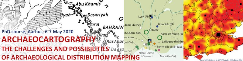
Distribution maps have been part of the archaeological toolbox since the dawn of the discipline. They serve as heuristic and analytical tools in research and as a visual form of data presentation in publication, shedding light on settlement structures, cultural territories and patterns of economic exchange and social interaction in the past. Today, mapping has become easier than ever, thanks to accessible GIS applications, widely available digitized spatial data, and decreasing technical limitations for publication. However, while there is ample scholarly attention for more sophisticated techniques of spatial analysis, there is surprisingly little recent debate about the creation, use and reception of the most common form of archaeological distribution maps - a relatively simple map representation of structured, spatial data concerning a limited set of archaeological phenomena.
This PhD course is organized around three basic but underexplored challenges in the creation of such humble, but ubiquitous distribution maps: classification, normalisation and visualisation.
Lecturers
Tom Brughmans is an archaeologist interested in studying the Roman economy, visibility networks and publication behaviour. He performs most of his work by applying computational methods, in particular network science, agent-based modelling and GIS. He is currently an associate professor in Classical Archaeology and UrbNet at Aarhus University.
Chris Green first experimented with archaeological map making as an undergraduate archaeologist in the late 1990s, followed later by an MSc in GIS, and a PhD on handling temporal probabilities in archaeological GIS. For the past eight years he has worked on archaeological GIS as a postdoctoral researcher in the School of Archaeology at the University of Oxford, where he worked extensively on the EngLaId project, which dealt with the collation, collision, and cartographic visualisation of very large archaeological datasets spanning all of England from 1500 BC to AD 1086. As a result, he has grown experienced in the wrangling of complex archaeological datasets and in converting them into comprehensible graphical outputs.
Peter Jensen manages the Unit of Archaeological IT based at Aarhus University and Moesgård Museum, and has an academic background in Prehistoric Archaeology and Digital Heritage. Peter's current focus is archaeological data models, web- and app-design, working towards online frameworks of open data, which contribute to scientific collaboration and public dissemination of archaeological data – textual and spatial.
Eljas Oksanen received his PhD in history from the University of Cambridge, UK, in 2007, and first became interested in the use of Digital Humanities tools for investigating historical and archaeological datasets during his postdoctoral research on relationships between continental landholders in Domesday Book. He is currently involved in various inter-disciplinary GIS-led research projects using documentary and archaeological material to examine economic growth, social change and the development of travel networks during the Middle Ages. Recently this work has included a project at the Portable Antiquities Scheme (PAS), British Museum, on analysing relationships between medieval commercial sites and objects in the PAS database of small archaeological finds.
Adéla Sobotkova started as a landscape archaeologist who combines pedestrian field survey with digital methods to map past human activities in their environmental context. After years of data collection, she now co-develops digital tools for archaeologists, teaches reproducible research, and studies the long-term history of the Balkans and Black Sea region, with focus on the evolution of social complexity. She runs her own regional survey project in Bulgaria, and consults the spatial and digital aspects of other projects in Greece, New South Wales, and Queensland.
Further information and registration
The registration deadline is Monday 6 April 2020. For information and registration, please see https://phdcourses.dk/Course/72669
For additional information and programme, download pdf.
