
Non-destructive 3D prospection at the Viking Age fortress Borgring, Denmark
New publication by Associate Professor Søren M. Kristiansen, UrbNet Deputy Director Professor Søren M. Sindbæk and colleagues.
Kristiansen, S. M., Stott, D., Christiansen, A. V., Henriksen, P. S., Jessen, C., Mortensen, M. F., Pedersen, J. B., Sindbæk, S. M. & Ulriksen, J. (2022). ”Non-destructive 3D prospection at the Viking Age fortress Borgring, Denmark”, Journal of Archaeological Science: Reports 42, 103351, https://doi.org/10.1016/j.jasrep.2022.103351.
Abstract
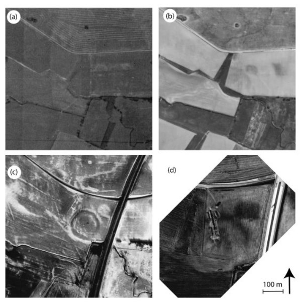
Non-invasive methods are increasingly important for understanding archaeological sites and their contexts. Larger earth-built constructions are nevertheless still difficult to study without extensive excavations. At the recently discovered Viking-Age ring fortress Borgring in Denmark a suite of non-destructive methods was applied with the aim of understanding how this highly eroded earthen fortress was constructed, and investigating how the construction of such a large monument altered the landscape. The methods were 1) residual relief modelling of airborne laser scanning data, 2) electromagnetic induction (DualEM 421 s) survey combined with coring, and 3) soil magnetic susceptibility measurements all to produce a 3D model of the palaeo-landscape and the fortress.
We found that the narrow natural promontory was enlarged to make space for the construction of the fortress’ rampart. The magnetic susceptibility of turfs from the rampart showed that both wetland and upland areas were alternately used for different compartments and explained the segmented anomalies comprising its construction. The combined results revealed a better archaeological understanding of the construction of the rampart, that the modifications of the landscape was somewhat comparative to the contemporary Fyrkat ring fortress site, and that the understanding of the landscape modifications were improved significantly by a multi-method 3D approach.